Cold front to bring summer snow flurries, send temperatures plummeting

A strong cold front is forecast to sweep the state this weekend, bringing snow to Victoria’s High Country and sending maximum temperatures at Mt Dandenong to 12 degrees.
The Bureau of Meteorology said the front is set to reach south-west Victoria on Thursday afternoon, move through central parts of the state that evening and then hit eastern regions on Friday morning.
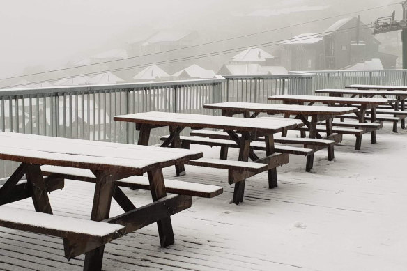
Snow blankets picnic tables at Mount Hotham in 2019. The weather bureau says snow in December is slightly more common than falls in January.Credit:Drew Jolowicz
“There’s going to be some really cold air behind that. Mostly, the coldest air will arrive on Friday over Victoria, and that could see some snow down to about 1300 metres over the alps,” meteorologist Christie Johnson said.
While flurries of snow are possible in some parts of the state on Saturday morning, Johnson said there wouldn’t be enough to justify packing your ski gear.
“You’d probably struggle to make a snowman.
“We probably won’t see it last on the ground for very long,” she said. “Even though there’s a lot of cold air, the ground is quite warm … it’s more likely to be flurries and maybe a little [bit of snow] settling, but it won’t last very long at all.”
Johnson said it was hard to track the history of summer snowfalls, as extensive records weren’t kept until recently.
“It’s quite common to get snow in December,” she said. “In January and February, it’s a bit less common.”
In the past two decades, snow has been recorded four times in January. In February, snow has been observed at Mt Baw Baw in 2019, at Mt Hotham in 2017 and at Mt Bulla in 2008.
“We’ve got some records from back in the 1950s and 1940s and 1930s, where there were big snow dumps in February,” she said.
“I can’t say that it didn’t happen any of the other years because it might have happened, just no one observed it or wrote it down.”
Cold temperatures are also not unusual – on average, each February parts of the state record two or three days with sub-zero temperatures, but snow is a little less common.
“It tends to get cold on those days where there are no clouds to trap the heat in,” the meteorologist said.
The south-west of the state will feel the chill of the cold front the most on Friday, with maximum temperatures of between 12 and 15 degrees tipped at Ballarat, Hamilton, Mt Dandenong and Macedon. In the alps, where snowfall is expected, a maximum of 1 or 2 degrees is expected.
Up through the north, temperatures will be slightly warmer, reaching the high teens and Melbourne is forecast to peak at a chilly 17 degrees on Friday.
“For Saturday, we’re looking at temperatures getting back up into the sort of low to mid-20s across the state,” Johnson said. “It’ll still be coolish for summer, but it will be significantly warmer.”
While there could be rainfall on Saturday morning, the cold front is expected to pass across the state by Sunday.
Our Breaking News Alert will notify you of significant breaking news when it happens. Get it here.
Most Viewed in National
From our partners
Source: Read Full Article