Victorian weather LIVE: State braces for ‘significant rainfall event’; flash flooding possible in Melbourne; regional towns threatened
Key posts
- Send us your rain pictures and videos
- Flood warnings across the state
- Rainfall hits Victoria as flooding threatens state
-
1 of 1
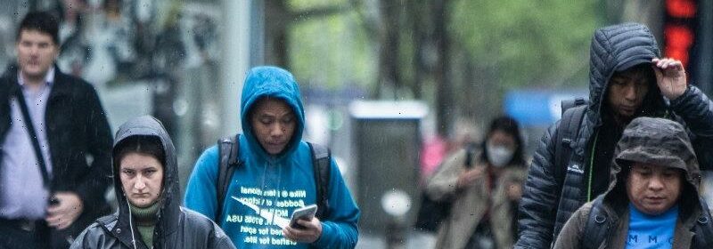
Send us your rain pictures and videos
If the rainfall today has particularly impacted you, let us know and send any videos or images below:
Flood warnings across the state
There are a number of Bureau of Meteorology flood warnings and watch and act alerts issued by VicEmergency in place, particularly in regional Victoria. Here are the areas impacted:
-
The Campaspe River, which runs through Rochester in the state’s north between Echuca and Bendigo, is subject to a watch and act alert and an initial major flood warning.
-
The Loddon River in Victoria’s north-west is also subject to a watch-and-act alert and a moderate flood warning.
-
The Ovens and King Rivers near Wangaratta in Victoria’s north-east are under a major flood warning. The King River is also subject to a watch and act alert.
-
The Goulburn River from Lake Eildon to Seymour in the state’s central-north is also subject to a watch-and-act warning and an initial moderate flood warning.
-
Echuca, Albury-Wodonga and Yarrawonga are also within a watch-and-act zone for flooding on the Murray River.
-
The Avoca River slightly further west of the Loddon in Victoria’s north-west is under a similar watch-and-act alert downstream of Charlton.
- The Acheron River, which runs south from Lake Eildon towards Marysville just to the north-east of Melbourne is also subject to a watch and act alert with a moderate flood warning.
For all the latest, keep up to date with this blog and check the VicEmergency website.
Weather overnight
Victorian Premier Daniel Andrews, state emergency services and forecasters warned on Tuesday this “significant weather event” would begin on Wednesday, but would begin to peak in intensity from the early hours of Thursday into Friday.
The Bureau of Meteorology reported early this morning that the highest rainfall totals since 9am Wednesday were in Strathbogie North to Melbourne’s north, with the area receiving 109 millimetres.
Second on the list was Charnwood – also near Strathbogie and just south of Euroa – with 105 millimetres. Third was Handcocks a little further to the north-east and south of Benella, which received 86 millimetres.
Melbourne also had enjoyed a surprisingly warm night, with the temperature sitting at 18.5°C at 1.30am. Even by 5.30am, the temperatures at the bureau’s Melbourne remained at 16.5°C.
Rainfall hits Victoria as flooding threatens state
Good morning and thanks for your company.
I’m Lachlan Abbott and I’ll be helming our live coverage this morning as Victoria prepares for a deluge to intensify which could bring flash flooding to Melbourne and inundate some towns in the state’s north.
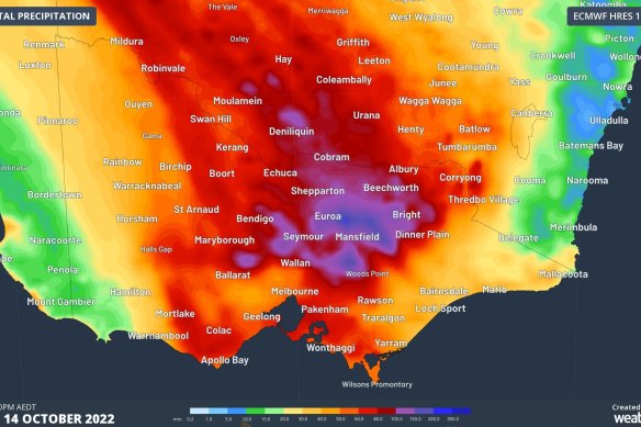
The latest rainfall prediction from the ECMWF-HRES (European) model for the next 72 hours in Victoria.Credit:Weatherzone / Ben Domensino
The Bureau of Meteorology’s latest severe weather warning, issued at 4:42am on Thursday, envelops most of the state, apart from areas to the east in Gippsland and the far south-west.
Falls are expected to be the heaviest north of the Great Dividing Range, including in north-west, northern, central and north-eastern areas.
Watch and act alerts and flood warnings are in place for a number of rivers in the north-western, northern, central and north-eastern areas.
This blog will provide flood warning updates throughout the day.
-
1 of 1
Most Viewed in National
Source: Read Full Article