Met Office issues London snow and ice warning

We use your sign-up to provide content in ways you’ve consented to and to improve our understanding of you. This may include adverts from us and 3rd parties based on our understanding. You can unsubscribe at any time. More info
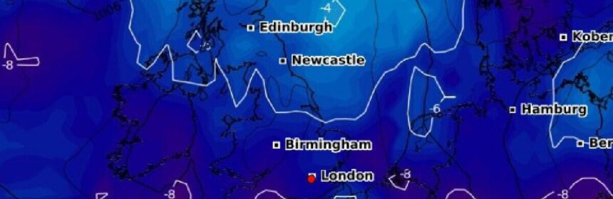
Britons should brace for travel chaos over the next week, with the UK’s Arctic temperatures to persist for seven more days.
Met Office weather forecasters have released a slew of warnings for the country following two days’ worth of bitter low temperatures.
Meteorologists believe the mercury could plummet low as -10C, with wintry downpours, “freezing fog” and snow for London.
The UK’s traditionally mild capital city could see several inches worth of snow, according to the forecast.
The new warning, which lasts for 24 hours from Monday, December 12, says two to five centimetres of snow could fall quite widely and up to 10cm in places.
It adds that there is a chance of travel delays on roads, trains and planes, as well as power cuts and injuries from slips on ice, while communities could be “cut off”.
The warning concedes that confidence is “very low” but states: “There is a chance that a band of sleet and snow could push into east and southeast England.
“This has the potential to give accumulations of 2cm to 5cm quite widely, and perhaps up to 10cm in some places, most likely, but not exclusively, over higher ground such as the South Downs, North Downs and High Weald.
“In addition, ice is likely to form on untreated surfaces, mainly nearer to coasts where rain or sleet is more likely.”
The weather warning will overlap with another from the UK Health and Security Agency (UKHSA) which also lasts until Monday.
More to follow…
Source: Read Full Article